
Eldfjallaeyjan Surtsey hefur verið valin mynd dagsins hjá Copernicus, jarðvöktunaráætlun Evrópusambandsins, í tilefni þess að 63 ár eru liðin frá því að eyjan reis úr hafi árið 1963.
Copernicus birti gervitunglamynd af Surtsey sem tekin var með Sentinel-2 gervitungli og sýnir einstakt landslag eyjunnar.
Surtsey er staðsett suðvestur af Vestmannaeyjum og myndaðist í eldgosi sem hófst 14. nóvember 1963 og stóð yfir fram í júní 1967.
Eyjan var tekin á heimsminjaskrá UNESCO árið 2008 og er mikilvægur rannsóknarstaður þar sem vísindamenn fylgjast með því hvernig gróður, fuglar og annað lífríki nema land á nýmyndaðri eyju.
Gervitunglamynd Copernicus gefur áhugaverða sýn á eina yngstu eyju Íslands, sem heldur áfram að taka breytingum rúmum sex áratugum eftir að hún reis úr sæ.
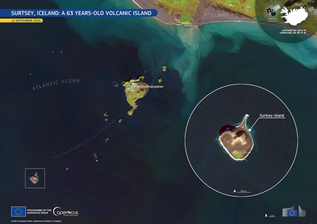
Heimild og mynd: Copernicus, jarðvöktunaráætlun Evrópusambandsins.
Skoða mynd dagsins á vef Copernicus
Surtsey featured as Image of the Day from Copernicus
Iceland’s volcanic island of Surtsey has been featured as the Copernicus Image of the Day, celebrating 63 years since the island emerged from the Atlantic Ocean in 1963.
The European Union’s Copernicus Earth observation programme highlighted the island with a satellite image captured by Sentinel-2, showcasing its unique volcanic landscape.
Located southwest of the Westman Islands, Surtsey was formed during a volcanic eruption that began on 14 November 1963 and continued until 1967.
Today, the island is a UNESCO World Heritage Site and an important natural laboratory where scientists study how plants, birds and other life forms colonise newly formed land.
The Copernicus image offers a remarkable view of one of Iceland’s youngest islands, which continues to evolve more than six decades after its formation.
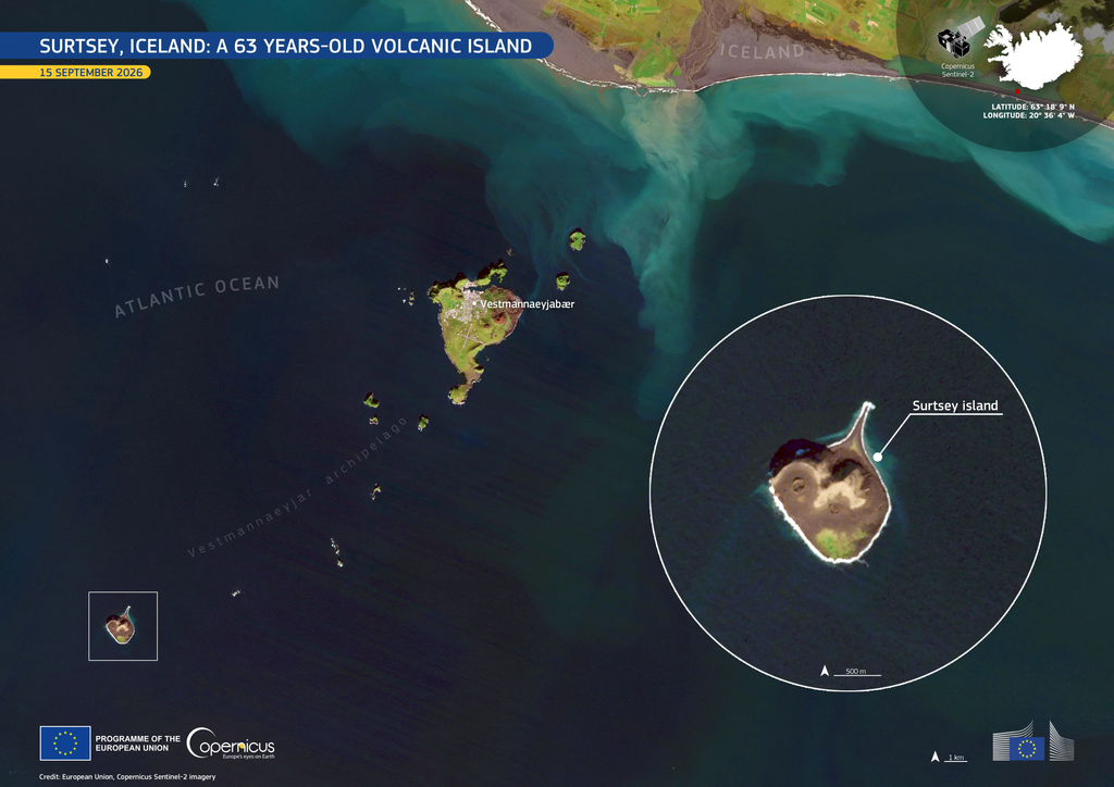
Source and image credit: European Union, Copernicus Sentinel-2 imagery.