-
Clean Space Training Course open for application
ESA Academy is receiving applications from highly motivated Master’s and PhD students in engineering disciplines to attend the 2026 edition of the Clean Space Training Course. The course will bring together 30 selected participants for an intensive training programme focused on the integration of environmental sustainability into space mission design. The Clean Space Training Course…
-
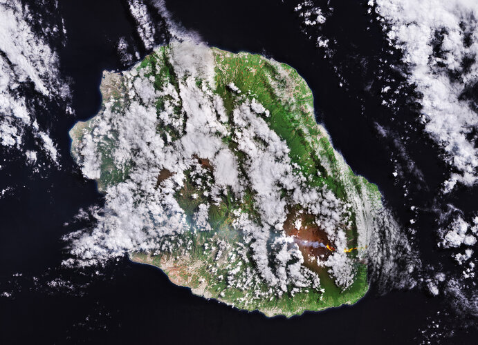
Antarctica’s vanishing sea ice transforms marine life
Shrinking ice is arguably one of the most visible indicators of climate change – particularly in the Arctic. However, a European Space Agency-funded study used information from satellites to show that Antarctica is now experiencing similar dramatic changes, with profound consequences for key plankton species that underpin the region’s marine food web.
-
CLCplus Core First Webinar
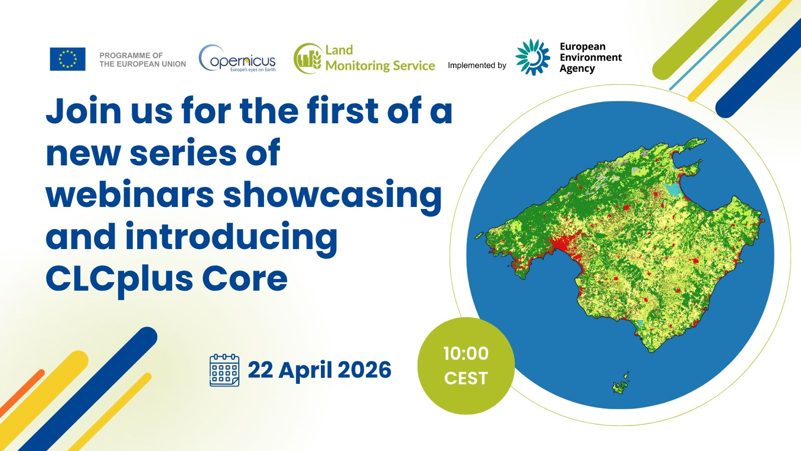
CLCplus Core First Webinar sonia Mon, 13/04/2026 – 14:31 CLCplus Core is a data creation platform for environmental land monitoring information. It provides a database and web mapping application that enables users to generate customised outputs, known as CLCplus Instances, tailored to specific policy needs and user requirements. These instances combine multiple Copernicus Land Monitoring…
-
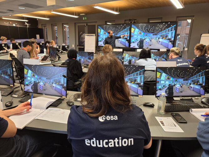
Fly Your Satellite! Industry Mentorship Initiative concludes Pilot Phase: supporting the next generation of satellite engineers
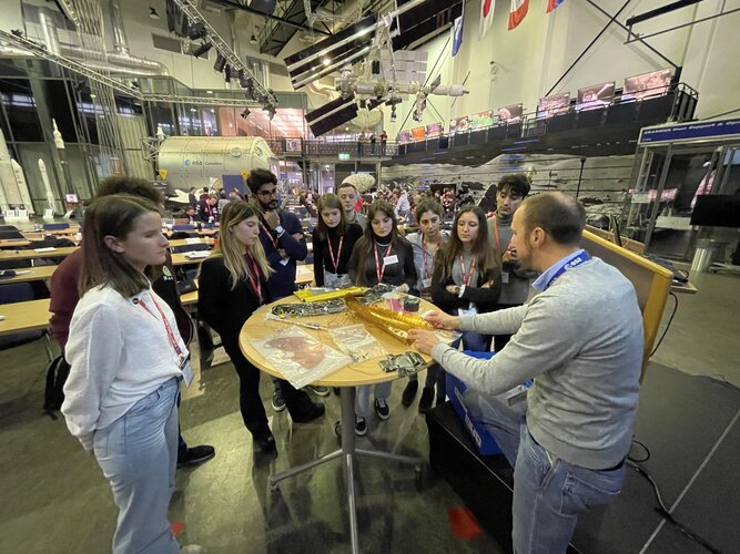
In June 2025, the ESA Education Office launched an industry mentorship initiative as part of the Fly Your Satellite! Educational Satellites programme, connecting university teams with professionals from the European space industry. Designed with the goal of broadening the student teams theoretical and practical knowledge and fostering their professional maturity, the initiative has now reached…
-
OBSERVER: Five Copernicus apps transforming climate and atmosphere insights
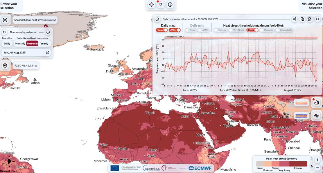
OBSERVER: Five Copernicus apps transforming climate and atmosphere insights sonia Thu, 09/04/2026 – 10:20 From assessing heat and cold stress to exploring historical climate data and future projections or mapping methane plumes and monitoring major aerosol events, a range of user-friendly digital tools from Copernicus is delivering climate and air-quality intelligence to users worldwide. Building…
-
New student teams for ESA Academy Experiments Programme
In February 2026, three new student teams were selected by the ESA Academy Experiments Programme Selection Panel to participate in the current cycle of the programme. Their projects tackle key challenges for future space missions, from understanding fluid behaviour in weightlessness to developing autonomous robotic capture methods and advancing cooperative spacecraft operations. Students will have…
-
ROSE-L radar unfolds in crucial ground test
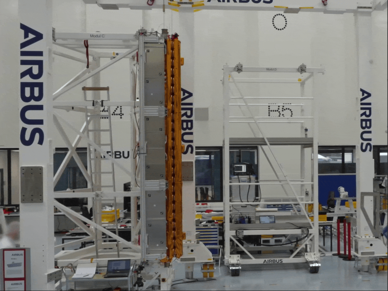
An important milestone has been reached in developing the upcoming Copernicus Radar Observing System for Europe in L-band satellite, known as ROSE-L. Engineers have tested the deployment of a structural model of its huge radar antenna – a key step towards preparing this new satellite for launch and its mission to monitor Earth’s land, oceans…
-
Student experiments launched on sounding rockets
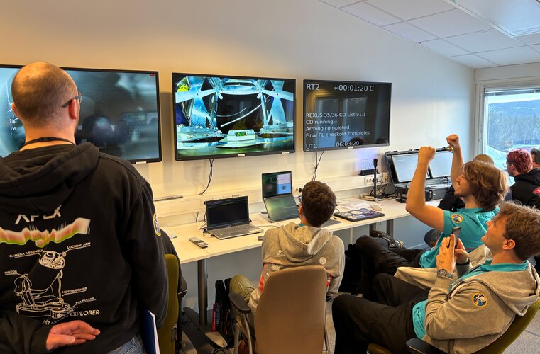
After more than a year of design, testing and development, dozens of European university students gathered in March to enact the final stage of their experimental projects in the REXUS 35 and 36 campaign. For two weeks, these students utilised the Esrange Space Center in northern Sweden to prepare and launch their various experiments on…