
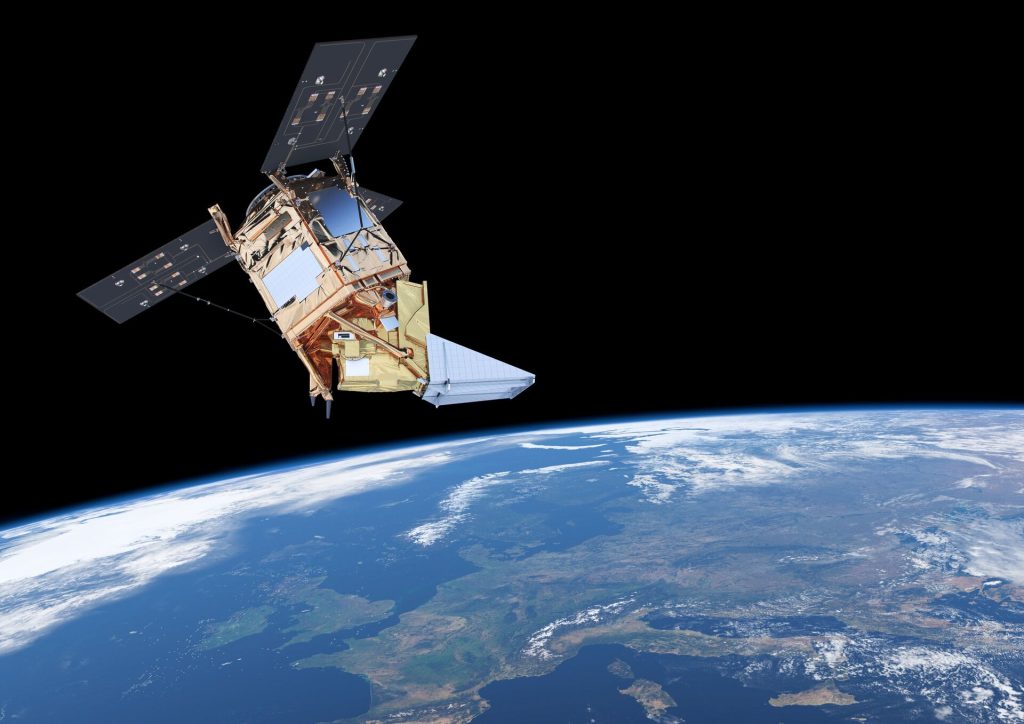
The Sentinel constellation is a series of Earth observation satellites under the Copernicus program, managed by the European Space Agency (ESA). It provides high-resolution imagery and data for land, ocean, and atmospheric monitoring, supporting environmental protection, disaster response, climate change studies, and sustainable resource management across the globe.
The Sentinel satellites are the core of the Copernicus program, providing the essential data and imagery that fuel its Earth observation services. Managed by the European Space Agency (ESA), these satellites enable Copernicus to monitor environmental changes, support disaster response, and contribute to climate change studies and sustainable management globally.
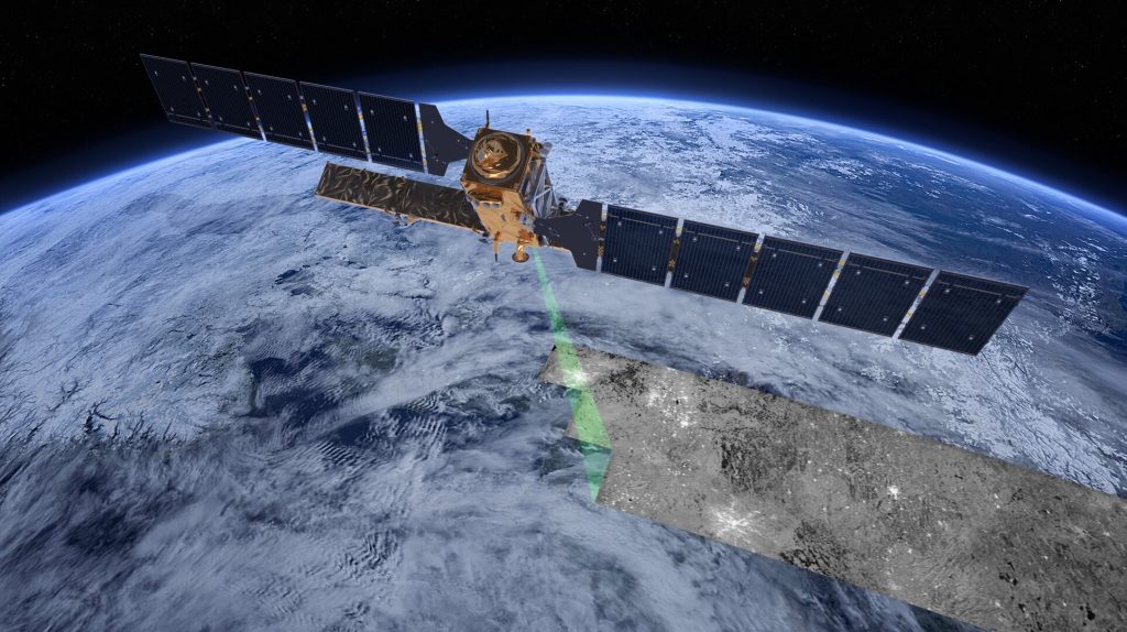
Sentinel 1
Description: Consists of two satellites that use radar to provide all-weather, day-and-night imagery of Earth’s surface.
Use: Used for monitoring sea ice, oil spills, and land surface movement, as well as disaster management.
Status: Launched [A] in April 2014 and [B] April 2016.
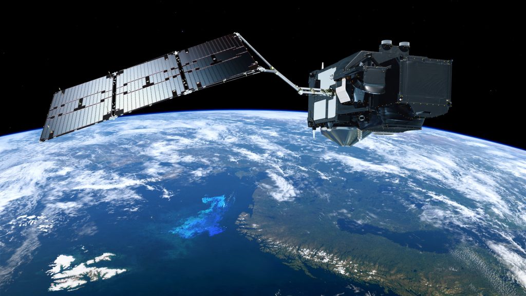
Sentinel 2
Description: Consists of two satellites that capture high-resolution optical images in 13 spectral bands.
Use: Used for land monitoring, agriculture, forestry, disaster control, and water bodies’ analysis.
Status: Launched [A] in June 2015, [B] March 2017 and [C] September 2024.
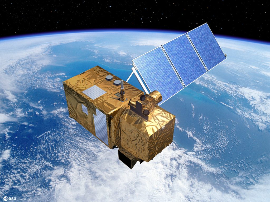
Sentinel 3
Description: Designed to measure sea-surface topography, sea and land surface temperature, and ocean and land color.
Use: Used for oceanography, climate monitoring, and environmental protection.
Status: Launched [A] in February 2016 and [B] April 2018.
Sentinel 4
Description: A payload carried on a geostationary satellite to monitor atmospheric composition, specifically focusing on air quality and ozone.
Use: Used for air quality monitoring and weather forecasting.
Status: Planned to launch around 2024-2025 as a payload on the MTG-S satellite.
Sentinel 5
Description: Monitors atmospheric gases, aerosols, and other elements that affect air quality and climate.
Use: Used for air quality monitoring, climate change studies, and atmospheric chemistry.
Status: Precursor [P] launched in October 2017; Planned for launch around 2025.
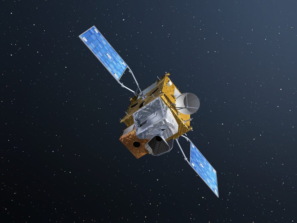
Sentinel 6
Description: Measures sea-level changes and provides high-precision data for oceanography and climate monitoring.
Use: Used for sea level monitoring, oceanography, and climate studies.
Status: Launched [A] in November 2020; Planned [B] for launch in 2025.
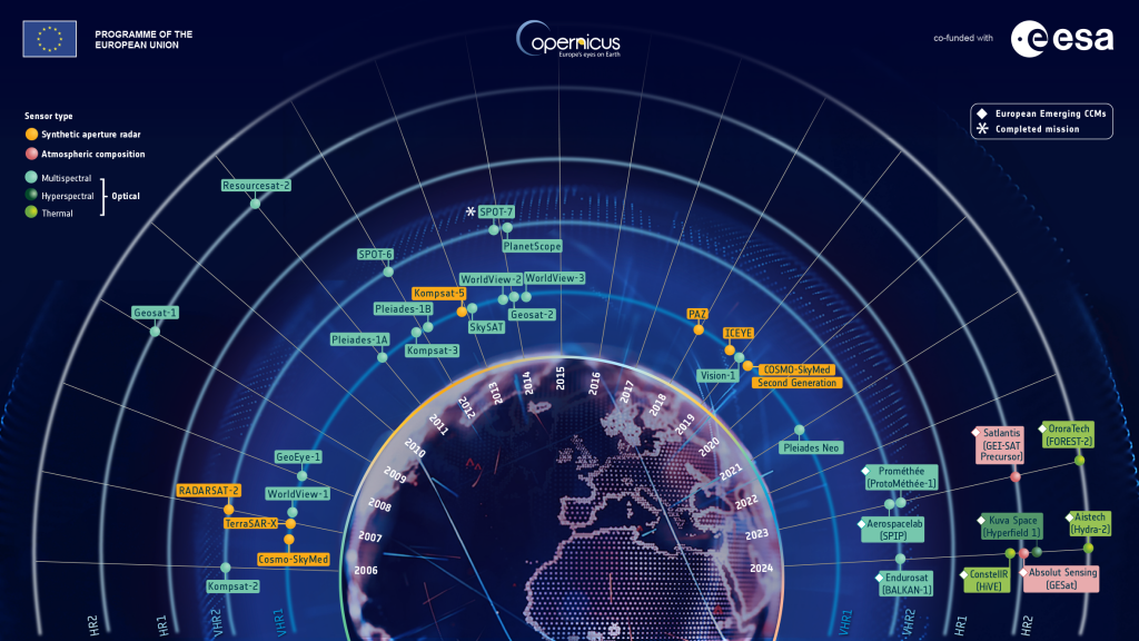
Contributing missions
The Copernicus Contributing Missions complement the dedicated Sentinel satellites by providing additional data from various sources, often with higher resolution or different sensing capabilities, whereas Sentinels focus on systematic, long-term monitoring of Earth’s environment.
Find out more about the Copernicus contributing missions here
Follow the live location of the Sentinel satellites in orbit here in the ESA Sentinel Dashboard
Read more about the Copernicus Sentinel Satellites here.
News about Sentinel data
- Planned upgrade of EOData repository 01/07/2026 from 07:00 to 09:00 CEST
- Copernicus Sentinel-5P Unavailability on 18 June 2026
- Copernicus Sentinel-3A unavailability notice for the IP manoeuvre #157 planned on 18 June 2026 [DOY 169]
- Sentinel-5p planned maintenance activities starting on 17/06/2026
- Copernicus Sentinel-3B unavailability notice for the IP manoeuvre #162 planned on 11 June 2026 [DOY 162]
- Copernicus Sentinel-3B unavailability notice for the SRAL Calibration planned on 04 June 2026 [DOY 155]
- Sentinel-1D SAR Data Quality Degradation
- Copernicus Sentinel-2 Night-Time Campaign Dataset
- Copernicus Sentinel-1D Data Unavailability on 29 May 2026
- Sentinel-1 orbital reconfiguration dates