-
Sponsorship for ISEB student program and IAC 2026
In the frame of the ESA Academy’s Engagement Programme, ESA Education offers European tertiary education students the opportunity to attend the International Space Education Board’s (ISEB) Student Program in conjunction with the International Astronautical Congress (IAC). This year’s IAC will be held from 5 to 9 October 2026 in Antalya, Turkey.
-
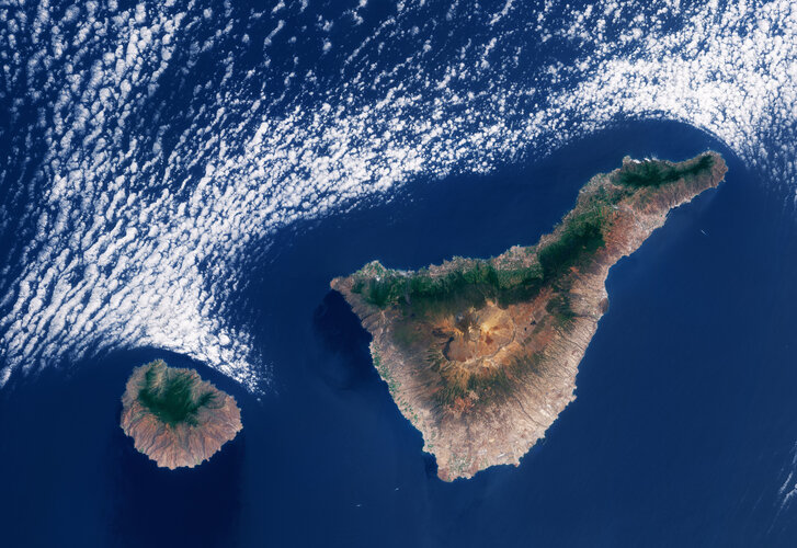
Stunning images from Biomass mark its one year in orbit
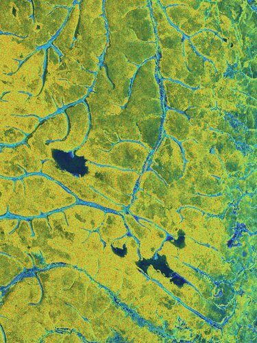
To mark the first anniversary of the European Space Agency’s Biomass satellite, we present a selection of striking images captured over the past 12 months, revealing Earth’s forests, and much more, in new detail. In just one year, this pioneering mission has begun transforming our understanding of forest dynamics and advancing how scientists monitor the…
-
Apply for Earth Observation Satellite Systems Design Training
ESA’s Education Office is looking for highly motivated Master’s and Ph.D. students in engineering or science disciplines to participate in the fourth edition of the Earth Observation Satellite Systems Design Training Course. This edition of the training course will also include 15 participants from Africa, selected as part of the broader African Union–European Union strategic…
-
Copernicus Thematic Services: Overview and Data Access (in Spanish)
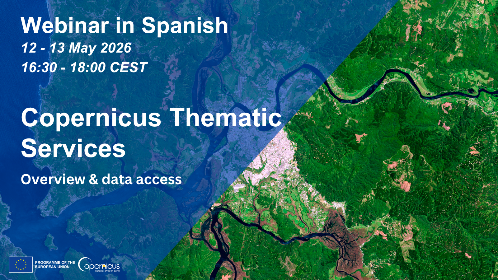
Copernicus Thematic Services: Overview and Data Access (in Spanish) sonia Fri, 24/04/2026 – 13:25 Join our two-day webinar in Spanish on 12 and 13 May 2026, from 16:30 to 18:00 CEST. The webinar will introduce five of the thematic Services of Copernicus, the Earth Observation component of the EU Space Programme, covering how Earth Observation…
-
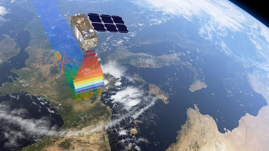
Braving the Arctic for upcoming polar-focused satellites
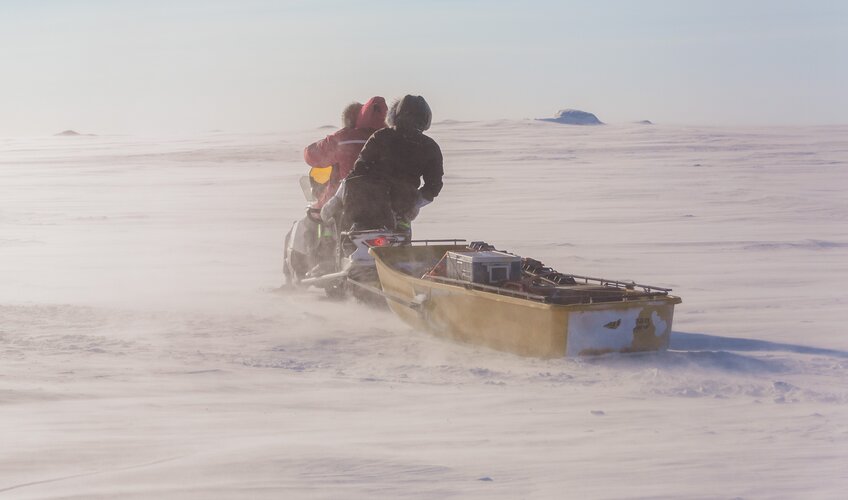
As sea ice continues to succumb to the climate crisis, measuring its decline with precision has never been more urgent. To meet this challenge, the European Space Agency is developing three new Copernicus satellites, each employing distinct but complementary techniques to monitor this fragile component of the Earth system. To ensure the data from these…
-
Why is Antarctica’s mass increasing?
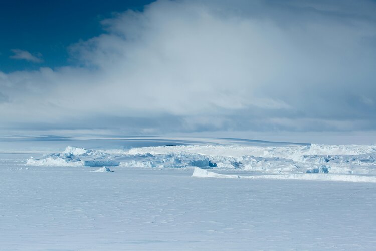
The Antarctic Ice Sheet has been growing since 2020 – and scientists have now identified why. Research funded by the European Space Agency (ESA) looked at factors affecting Antarctica’s delicate environmental dynamics. Despite accelerating loss of ice through glacier melt, exceptionally heavy snowfall in recent years is adding to the mass of the icy continent.
-
2026 CLMS General Assembly and user events
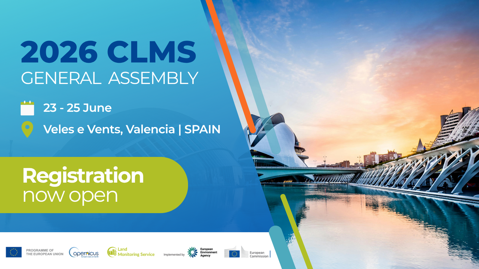
2026 CLMS General Assembly and user events admin Thu, 23/04/2026 – 14:46 When Jun 23, 2026 09.00 to Jun 25, 2026 14.00Time zone: Copenhagen, Denmark Where Veles e Vents in Valencia, Spain Contact name Claudia Alsager Type Conference Hosting organisation European Environment Agency and the DG Joint Research Centre of the European Commission Add event to calendar…
-
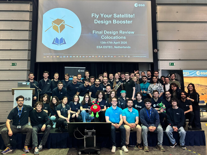
ESA Academy Case Studies Programme
The ESA Academy Case Studies Programme invites student teams, enrolled in a tertiary education institution in an ESA Member State or Associate Member, to work on ESA-originated topics over a period of 2 to 6 months, with light mentoring from ESA experts. ESA Academy Case Studies can be integrated by professors into a course or…