-
Satellites in tandem reveal 30 years of Antarctic ice flow
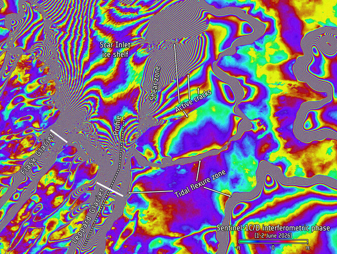
Thirty years after the European Space Agency first demonstrated the power of flying two satellites in very close formation, the concept was recently recreated. By temporarily positioning two Copernicus Sentinel-1 radar satellites to replicate the pioneering ERS-1–ERS-2 ‘tandem mission’, ESA achieved one-day repeat radar imaging of the same Antarctic region. The results once again demonstrate…
-
Unpacking Europe’s new weather imagers
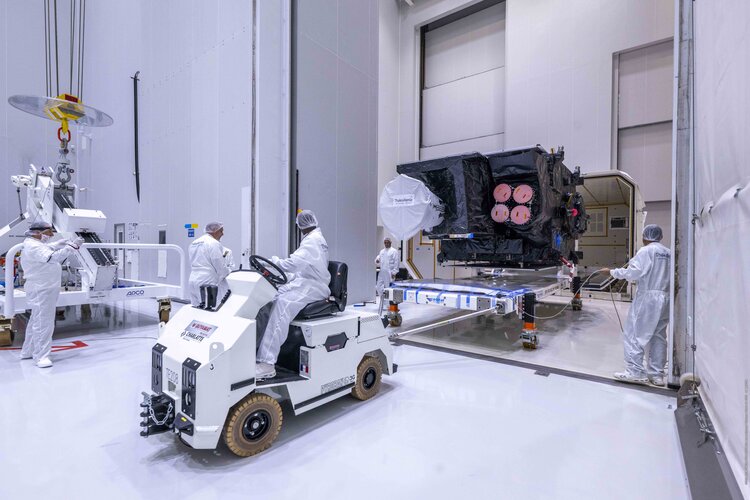
The second Meteosat Third Generation Imager satellite (MTG-I2) has begun its launch campaign, during which it will go through final inspections before being fitted inside the fairing of the Ariane 6 rocket that will launch it into space towards the end of the summer. So how will this 3800 kg satellite help improve weather forecasts…
-
Authorisation paves the way for Aeolus-2 wind mission

Building on the remarkable success of the Earth Explorer Aeolus wind mission, the European Space Agency has given Airbus Defence and Space in the UK the authorisation to proceed to begin the development of Aeolus’ successor, Aeolus-2 – which is set to be built to enhance operational weather forecasts.